Biodiversity of Taipei City
Taipei City is located in the Taipei Basin, surrounded by mountains and rivers. The north has the Datun Mountain System and the Qixing Mountain System, the east has the Wuzhi Mountain System and the Neihu Mountain System, the south has the Erge Mountain System, and the west side has the Tamsui River system. With rich topographic changes, there are forests, plains, wetlands, rivers and other diverse ecosystems, inhabited by different kinds of organisms.
In the case of Taipei City, we are generally referred to as the urban ecosystem. But if we look closely at its contents, there are still many types, such as streams, forests, grasslands, wetlands, farmland ecosystems, etc. The following is a description of Taipei's characteristics from the perspective of biodiversity.
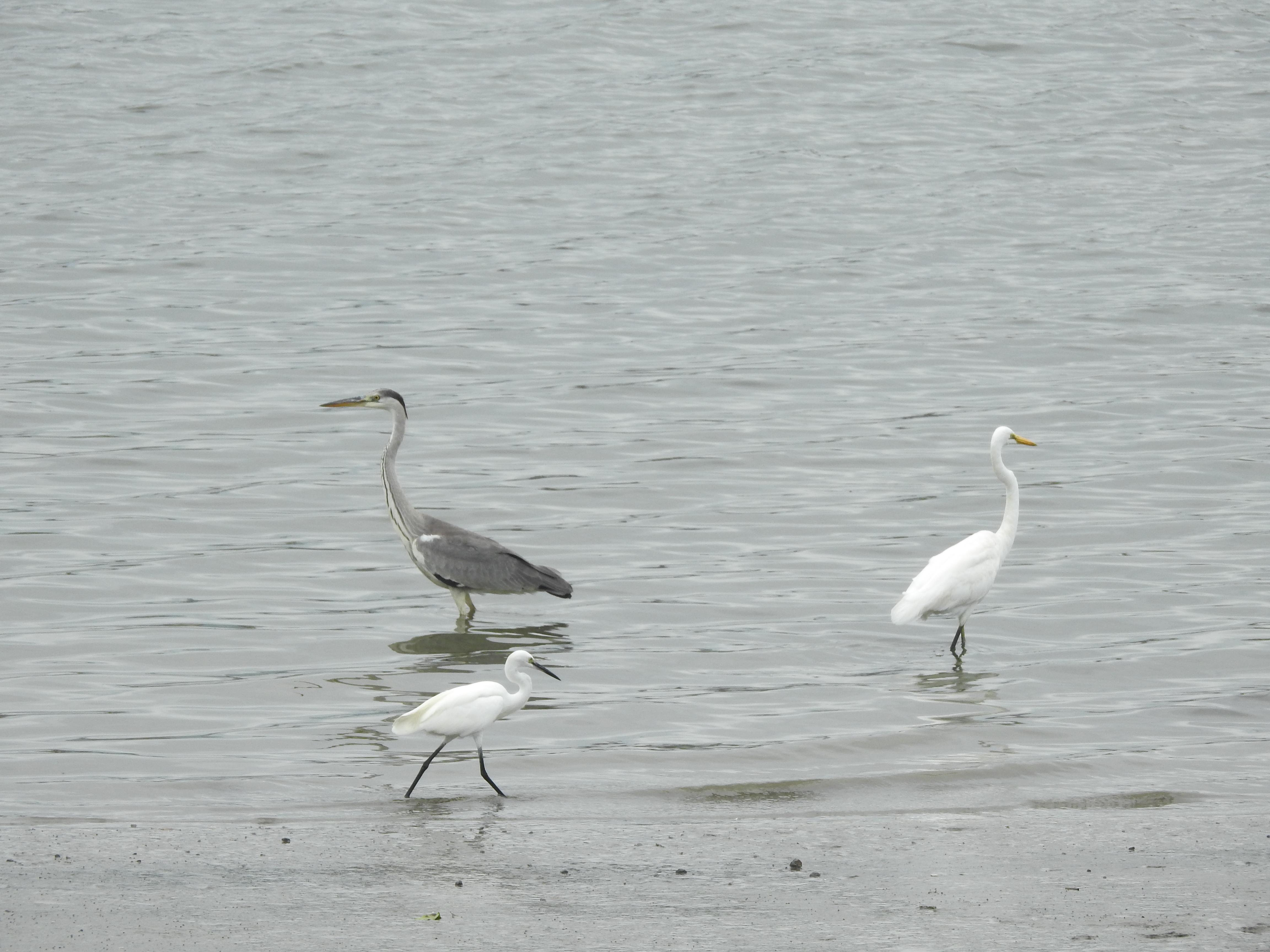
Photo by Spatial Ecology Lab, NTU
Species diversity in Taipei City
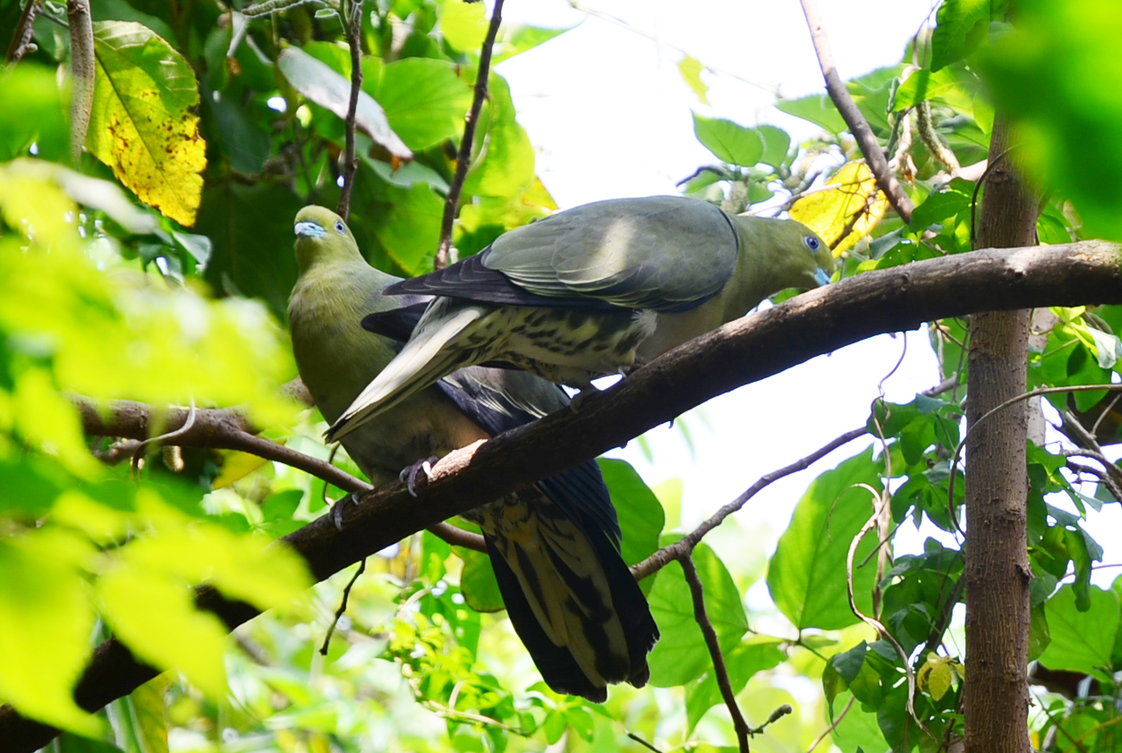
Taipei City has implemented the Biodiversity Indicator Survey Program since the autumn of 2007, which has lasted for 16 years until 2022. As of 2022, 200 species of birds, 186 species of butterflies, 119 species of fish, 72 species of dragonflies, 4744 species of plants, 60 species of shrimp and crab snails, 23 species of amphibians, and 42 species of reptiles have been found. Most of them are native species, however, there are many species are alien.
Ecological diversity of Taipei City
Taipei is located between the East Asian continent and the Pacific Ocean. The weather is a typical subtropical monsoon climate with winter affected by the East Asian monsoon and Mongolian high pressure, summer influenced of the Pacific high pressure and typhoon. Due to the basin terrain in Taipei, summer heat is not easy to discharge, the temperature in the urban area is higher, so the summer is more stuffy, the winter is more humid. Such a climate and diverse terrain create different ecosystems, and human development has also created different ecosystems. The ecosystems of Taipei City include forest, grassland, river, lake, wetland, agriculture and urban.
.jpg)
Shezidao Riverside Park photo by 李承恩
Forest ecosystem
According to a book published in 1697, Taipei City used to have lush forests. This book described that the forests were lush with the tree sizes indistinguishable, and old vines entangled on trees. After three hundred years of reclamation and logging, most of the original forests in the surrounding mountains of Taipei City have long been changed. Only some primitive natural forests can be seen in Yangmingshan National Park.
In the above the 300 m mountainous region where Yangmingshan National Park exists, the climate are warm and temperate. The forest structures are complex with high species diversity. Tree species are composed of Lauraceae and Fagaceae, while the grounds are mainly annual grass species. Some of the native forests in the Yangmingshan were harvested and replanted with Japanese Cedar ( Cryptomeria japonica ), Taiwan Acacia ( Acacia confuse ) and Taiwan Red Pine ( Pinus taiwanensis ). These species become the dominant forest landscape in this region in the past. However, the landscape has been changed and the forests are gradually converted into native forest by nature regeneration.
.jpg)
Qixingshan Trail photo by 李文玉
Below the 300 m mountainous region, the forests occur in humid, relative ly high temperature and rainy climate, Major tree species belong to the groups of Machilus (Lauraceae) and Ficus (Moraceae). Terns are dominant in the ground level. The vegetation are characterized with buttress root, stranglers, tree ferns, and epiphytes. The areas were disturbed by human activities. The secondary forests are dominant with intolerant pioneer trees such as Acacia confusa (Fabaceae), Acacia confusa (Fabaceae), Schefflera octophylla (Araliaceae), and Castanopsis carlesii (Fagaceae).
.jpg)
Surrounding Suburbs photo by 李文玉
Grassland ecosystem
In Yangmingshan National Park, the peak areas of Mt. Qixing and Mt. Datun are dominant of grassland landscape. Thus, Yangmingshan has also known as “grassy mountain”. This is the most representative grassland area in Taipei.
The grasslands on Yangmingshan can be roughly divided into pasture grasslands and mountain-top dwarf bamboo grasslands. Ranch grassland is known as Qingtiangang Grassland, which is formed by artificial opening up of planting grass during the Japanese occupation period. The land of Qingtiangang Grassland was flat. During this period, Japanese began to grow pasture to provide cattle grazing in order to generate beef for military supplies. This cattle grazing landscape is now changed due to the social transition with few cattle raised. As a result of less cattle gnawing, succession in some areas gradually convert this carpet-like grassland to the original tall grass landscape dominated by Silver-grass ( Miscanthus floridulus ). Grassland species can be broadly divided into Usawa cane ( Arundinaria usawai ), Silver-grass and artificially planted Carpet grass ( Axonopus compressus ).
.jpg)
Qingtiangang photo by 李文玉
The hilltop dwarf arrow bamboo grassland is distributed in the mountainous area above 800 m above sea level and dominant of Silver-grass and arrow bamboo grassland. Due to the strong northeast monsoon and steep terrain, trees are difficult to grow in this region. Plant species such as Usawa cane and Silver-grass took advantage to occupy this environment. Only a few broad-leaved trees exist in the valleys. Usawa cane prefers the wet and cold environment, often grows in the northeast monsoon windy hillside, while Silver-grass is dependent on sunshine and prefer more dry and hot sunny surface. There is also mixed area of the two groups. The boundary between grassland and forest often changes due to factors such as climate and wind, and here you can observe the landscape of Trochodendron aralioides (a sole living species in this genus and relic in East Asia), Crenate-leaved Eurya ( Eurya crenatifolia ) and grasslands.
.jpg)
Arrow Bamboo Forest photo by 李文玉
Stream ecosystem
Rivers can be regarded as a dynamic and continuous ecosystem, starting from the upstream source all the way downstream to the estuary, with different topographical landscapes and ecological compositions.
The environment in the upper reaches of the mountain forest is highly natural with steep slopes, turbulent water flows, medium- and large-sized stones, and intersecting waterholes and rapids. From an ecological point of view, the upstream area has clear water quality, high dissolved oxygen and complex habitat. After the mid-stream, the river gradually open, slope and the flow rate slow down.
.jpg)
Waishuanghsi River photo by 李承恩
There are more slow flow or deep pool water body, the bottom of the river bed is rich with sedimentation, water also become turbid and muddy. Humans develop agricultural practices or settle on the relative flat area along the river. Due to the influence of human activities, the pollution level in this section of river is relatively high.
.jpg)
Jingmei River photo by 李文玉
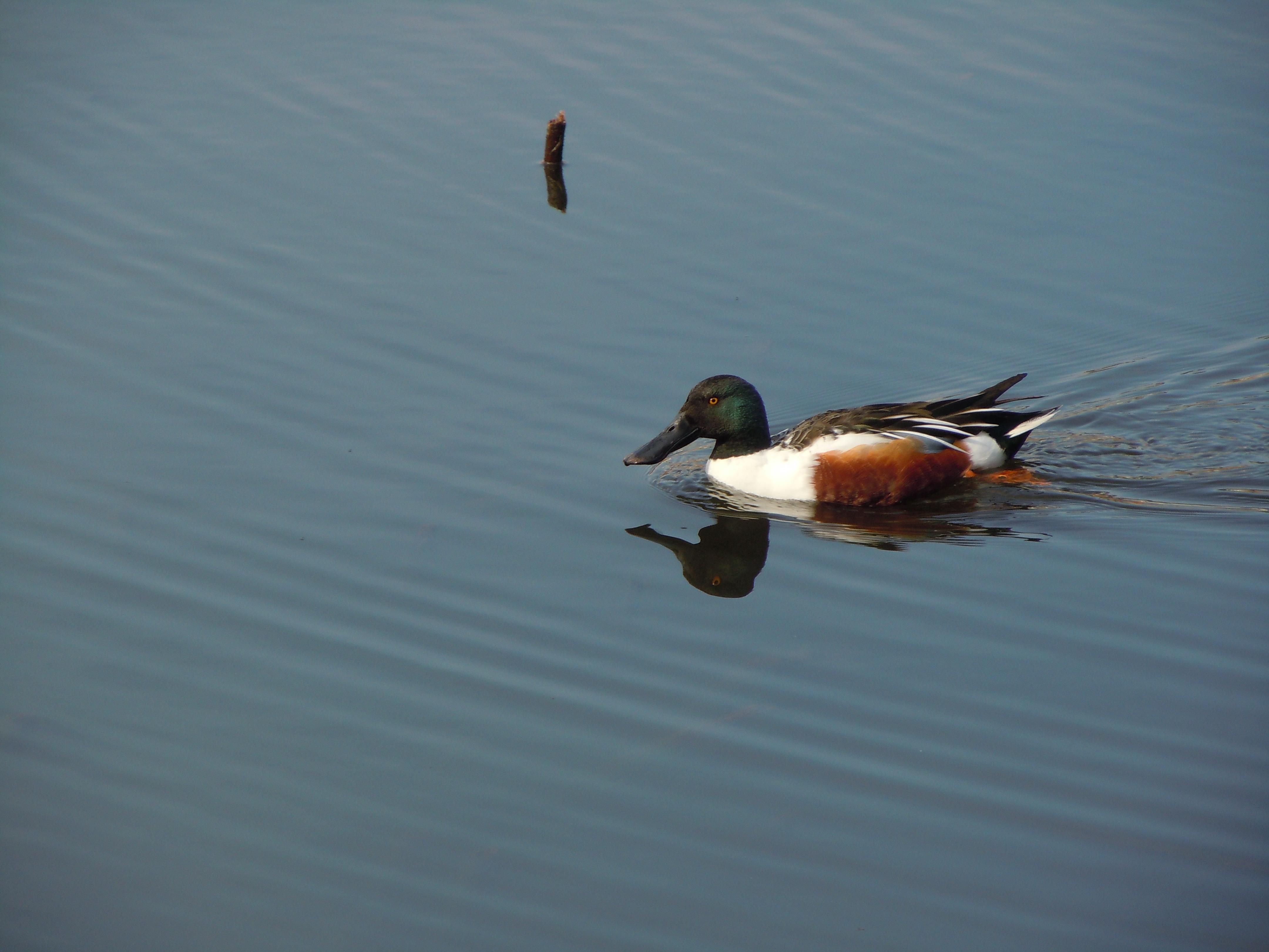
Downstream areas bring together the main and tributary water bodies. Coupled with human activities, domestic and industrial sewage affected water quality and biological habitats. The organisms living in the river are facing very high survival pressure. Close to the estuary, due to the mixture of freshwater and salt water condition, the fish species are mostly peripheral freshwater fish that can use either sea water or freshwater environment.
Taipei City is located in the lower reaches of the Tamsui River and Keelung River, and the ecological status of the downstream areas described above can also be seen in the rivers of Taipei City.
.jpg)
Tamsui River photo by 李文玉
Lake ecosystem
Lakes are water bodies accumulated in relatively low-lying areas of the land. Compared with rivers where water bodies are constantly flowing, lakes are static water environments. Under a long natural succession, the lake accumulates sediments that reduce the area of water body and gradually evolve into marsh wetlands. Then, land-based plants and animals gradually move in, and lakes will eventually evolve towards land.
Menghuan Pond in Yangmingshan National Park is the most famous natural lake in Taipei. Menghuan Pond is located in the eastern side of Mt. Qixing. Because the pond is one of the few lakes in this region that has not been invaded by sulfur spring due to the existence of many volcanoes, the pond hosts a rare aquatic plant, i.e. Taiwan Quillwort ( Isoets taiwanensis ), provides water source for mammals, birds and frogs. Due to recent leak of water in the pond bottom and change of vegetation structure, the pond is in the final stage of natural succession that will evolve toward land.
.jpg)
Menghuan Pond photo by 李承恩
In addition to natural lakes, there are many man-made pools and ponds in Taipei. More than 200 years ago, our ancestors settled in the Taipei Basin and built many water ponds to reclaim irrigation fields, which were made of mounds and terrain embankments. With the development of modern Taipei, many ponds have been filled, cemented on the banks of ponds and so on, and lost their original appearance and function. Currently the remaining ponds have shifted from agricultural irrigation to recreation.
.jpg)
Dahu Park photo by 李承恩
Wetland ecosystem
Wetlands are important ecological environment that have the functions of flood control, water quality purification, pollutants filtering, coastal protection and habitats for many wildlife.
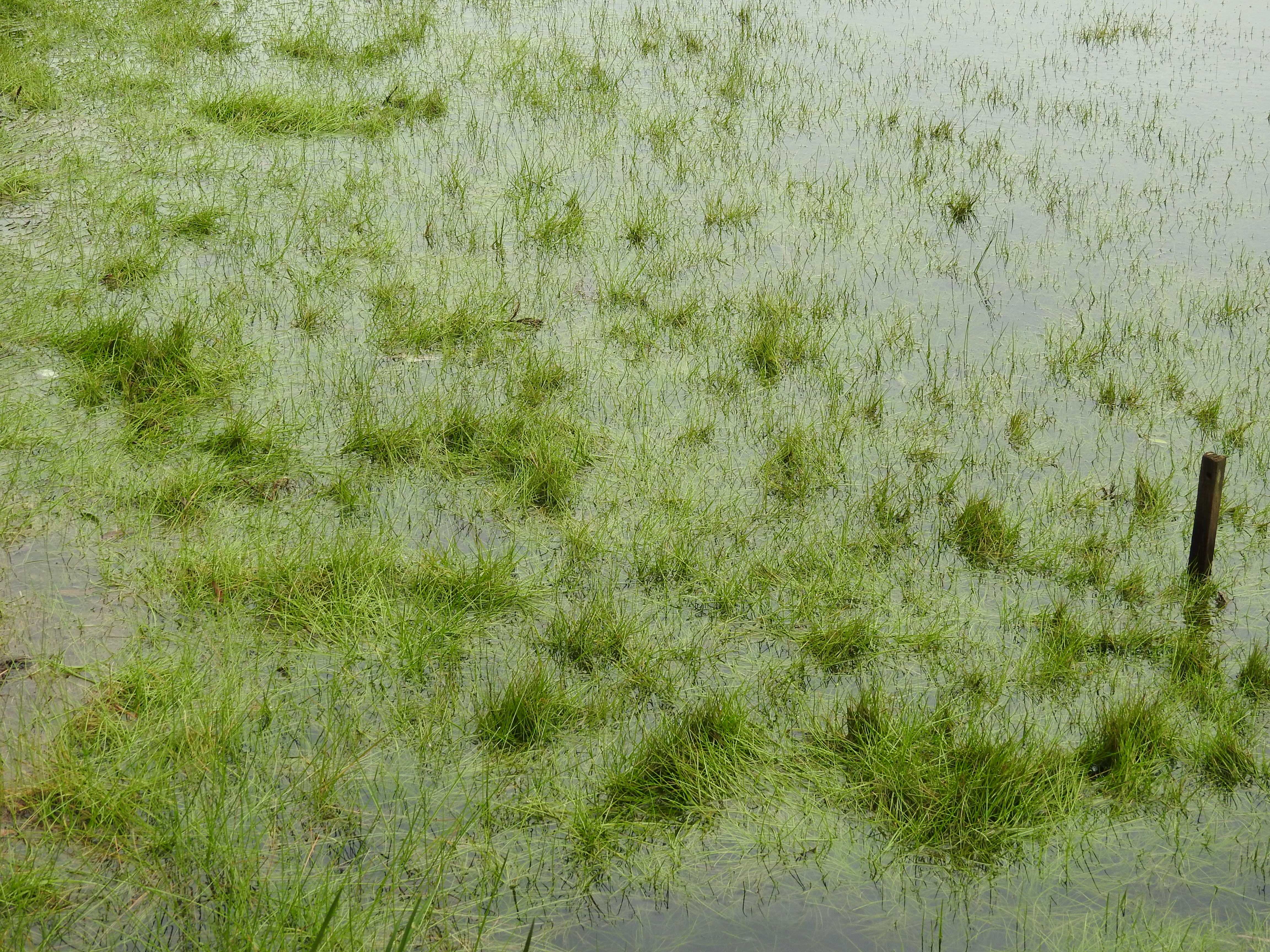
There are many rivers that run through the Taipei Basin, and form wetlands at river catchments and low-lying areas. In Taipei, three wetlands, including Guandu Nature Park, Guandu Nature Reserve and Waterfowl Refuge, are designated as the Important Wetland (national level) under the Wetland Conservation Act. One artificial pond was designed as local level Important Wetland.
.jpg)
Guandu Nature Park photo by 李文玉
Agricultural ecosystem
The main and relatively large agricultural land in Taipei City is the Guandu Plain and Shezidao where the Tamsui River and Keelung River converge, and these paddy fields provides food resources for many insects and small vertebrates, and become habitats for migratory bird populations.
Due to the shift of industrialization, the salinization of cultivated land and many other factors, Taipei's agricultural ecosystems face the fate of waste tillage and land development. Overuse of chemicals and agricultural fertilizers threatens the organisms that inhabit the land. Although these paddy fields are important for biodiversity, they are also facing the fastest disintegration of habitats in Taipei.
.jpg)
Guandu farmland photo by 李文玉
Urban ecosystem
Most lands in Taipei city has been developed for industrial, commercial and residential usages. These urban trend is generally considered against nature. However, the urban edge adjacent to rural land and the metropolitan area of parks, roadside trees, schools or residential planting and green space are habitats for many wildlife species adapting to the metropolitan environment. Although these green spaces are fragmented, small in size and vulnerable to human interference, they serve as refuges for many terrestrial species.
.jpg)
Fuyang Eco Park photo by 李文玉
Heat island effect is common in urban environment. Green space in the city has become an effective mitigation to reduce this effect. Thus, urban green spaces act as leisure and ecological conservation functions to reduce urban heat and provide biodiversity protection.
.jpg)
Photo by 李文玉